
SHIRES
Shire of Quairading
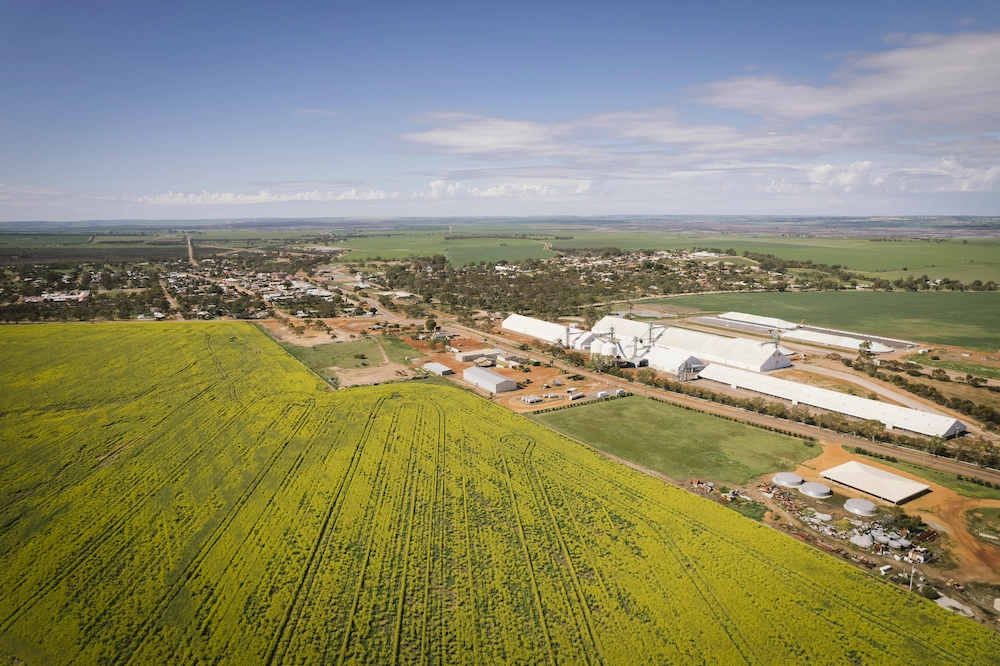
The Shire of Quairading is 2,017 square kilometres in area and has a population of 961 (ABS, 2021 Census).
Key industries within the Shire of Quairading include cereal and livestock farming, public administration and safety, health care and social assistance and education and training.
The Shire of Quairading is located 164km east of Perth and includes includes the localities of Quairading, Pantapin, Yoting, Badjaling, Dangin, South Caroling, Balkuling, Doodenanning & Wamenusking.
History
The name Quairading is derived from the Aboriginal word ‘Kwirading’, meaning the home of a small bush kangaroo.
In the early days, Aboriginal people lived a nomadic lifestyle throughout the Dangin area, which provided good hunting grounds and access to waterholes. At times, an estimated 600 to 800 Aboriginal people camped near Dangin Springs, which was the only water supply for many miles around.
The name ‘Dangin’ is an Aboriginal word associated with the needle bush, which grows in abundance throughout the area. In 1836, Mr Stephen Stanley Parker took up a pastoral selection at Dangin Springs. Farming commenced in the area in 1859 when his son, Edward Read Parker, moved there. Stephen Parker also owned Crown Grant land in York and went on to become one of the wealthiest pastoralists in the Avon Valley region.
The farming property, known as ‘Dangin Parker Estate’, was further expanded by Edward’s son, Jonah Smith Wells Parker, who acquired an additional 16,000 acres, making it one of the largest farming properties in Western Australia at the time. In addition to experimenting with wool, mutton, pigs and sandalwood production, Jonah Parker pioneered the production of eucalyptus oil in 1882.
In the early 1900s, the Government opened up new areas of land for people seeking work and somewhere to settle permanently. Quairading was one such area. Between 1903 and 1908, many new settlers moved to the district and began clearing the land. Settlers were given a 160-acre homestead block free of charge, on the condition that they lived on the property and improved it over a period of seven years.
The town of Quairading was officially gazetted on 7 August 1907. A railway extension from Greenhills to Quairading was completed in 1908, with Quairading at the terminus. A small settlement soon developed, and by 1909 there was a hotel, general store, blacksmith, baker, carpenter and two banks.
The Quairading district continued to grow, and by 1950 there was very little farming land that had not been cleared and brought into production. The small community at Dangin was eventually disbanded in favour of a central settlement at Quairading. Dangin’s status as a ‘dry’ town also contributed to its decline, as people were drawn to the licensed hotel in Quairading.
Improvements in technology and farming methods have resulted in a steady increase in production over the years. Today, Quairading is an attractive and safe place to live, work and farm, with a range of quality facilities and amenities for individuals, families and retirees.
Shire Snapshot
Total Area
2,017km²
Population
961
Sealed Roads
288km
Unsealed Roads
654km
Estimated GRP
$51.204 million (0.6% of Wheatbelt GRP)
Industry
Agriculture is the largest output generating sector, with an estimated annual output of $59.87 million
Employment
Agriculture is the largest industry of employment, supporting an estimated 150 jobs
ATTRACTIONS
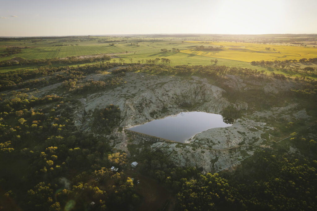
Toapin Weir
The top of this natural granite outcrop offers stunning 360-degree views across the surrounding landscape. Electric barbecue and toilet facilities are available for visitors.
Toapin Weir is the largest and most comprehensive privately constructed reservoir and water scheme in Western Australia. The weir was listed on the State Register of Heritage Places in 2012.
Address: Located 8km North West of Quairading on Toapin Weir Road
Nookaminnie Rock Nature Reserve
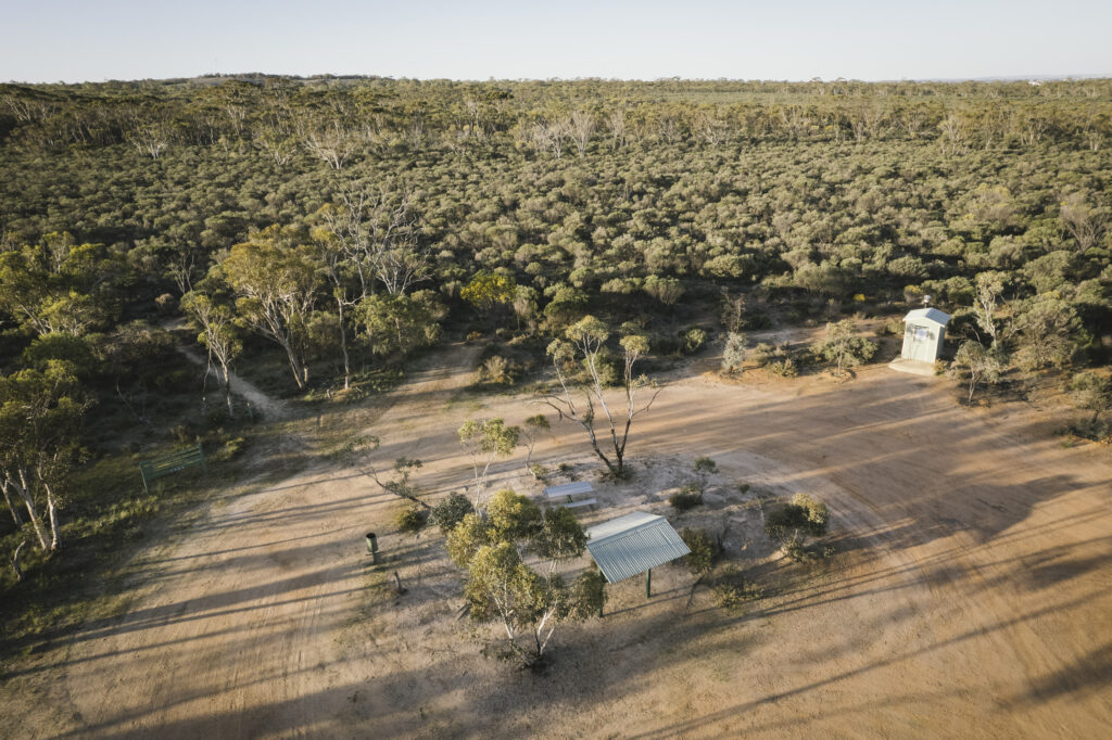
Nookaminnie Rock Nature Reserve covers 527 hectares of unique remnant vegetation, including a diverse mixture of woodland and native shrubland. The open woodland areas contain outstanding examples of wandoo, York gum and salmon gum forests that are characteristic of the Central Wheatbelt.
At the heart of the reserve is Nookaminnie Rock, a large granite outcrop offering magnificent views of the surrounding landscape and the town of Quairading. The top of the rock provides an excellent vantage point to watch the Wheatbelt’s spectacular sunsets. In spring, visitors can also enjoy the wildflowers for which the Wheatbelt is renowned.
Marked walking trails provide easy and safe access to the rock.
For more information on the Rowlie Mellor Walk trails including maps, visit https://trailswa.com.au/trails/trail/rowlie-mellor-walk-trails
Address: 2km west of the Quairading Townsite on the Quairading-York Rd
Rabbit Proof Fence
The Rabbit-proof Fence is one of Western Australia’s most significant historical structures. Two recreated sections of the fence and associated rabbit traps are located south of Quairading on Corrigin Road.
There are three rabbit-proof fences in Western Australia. The original No. 1 Fence crosses the State from north to south, while No. 2 Fence is shorter and located further west. No. 3 Fence is smaller again and runs east-west. Construction of the fences took six years.
When completed in 1907, the three rabbit-proof fences stretched a combined 3,237 km (2,023 miles).
Address: South of Quairading on the Corrigin Road.
Mount Stirling
Mount Stirling is a striking granite outcrop rising above the Central Wheatbelt landscape. It is a popular destination for visitors exploring the region, particularly during spring when the surrounding countryside is filled with wildflowers.
For those who are fit and agile, climbing the rock provides an opportunity to enjoy panoramic views from the summit.
The rock is surrounded by wildlife sanctuaries that provide habitat for black-flanked rock-wallabies. Keep an eye out for these timid native marsupials.
According to local stories, the large granite rocks represent the coils of a giant serpent believed to have lived in the surrounding waterholes.
Address: Kellerberrin-Yoting Rd, Quairading 6383
Badjaling Nature Reserve
Badjaling Nature Reserve is a 272-hectare reserve of native bushland located at Badjaling and managed by the Department of Parks and Wildlife.
The reserve contains a variety of vegetation communities, including shrubland, woodland, halophytes around a saline watercourse and areas of heath. The woodland is primarily made up of low, shrublike trees, including Banksia and Xylomelum species.
A 1980 survey recorded 111 plant species within the reserve. The survey did not include the endangered Banksia cuneata (Quairading Banksia), which had been discovered in the reserve in 1971 but was not formally published until 1981.
Address: 13km east of Quairading
Pink Lake
The Pink Lake near Quairading is regarded locally as a natural phenomenon. At certain times of the year, one side of the lake can appear dark pink while the other remains a lighter pink.
During summer, evaporation causes the water level to drop and salt to accumulate on nearby fences and trees. Changes in water levels and salinity contribute to the lake’s distinctive colouring.
Address: 11km east of Quairading on the Bruce Rock Road.
El Toro
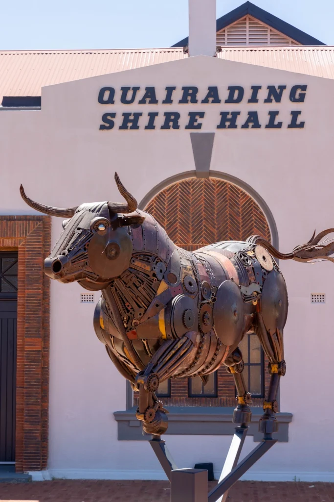
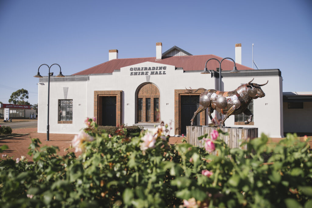
El Toro is a life-size Spanish bull expertly sculpted from recycled metal parts by Narembeen artist Jordan Sprigg. The sculpture stands proudly in Quairading, currently outside the Town Hall.
Representing strength, passion and prosperity, El Toro is one of the stops on Jordan Sprigg’s Art Trail, which features sculptures located across Western Australia.
Address: The Shire Hall is located next to the Shire Office, on Jennaberring Road.
Kwirrading Koort
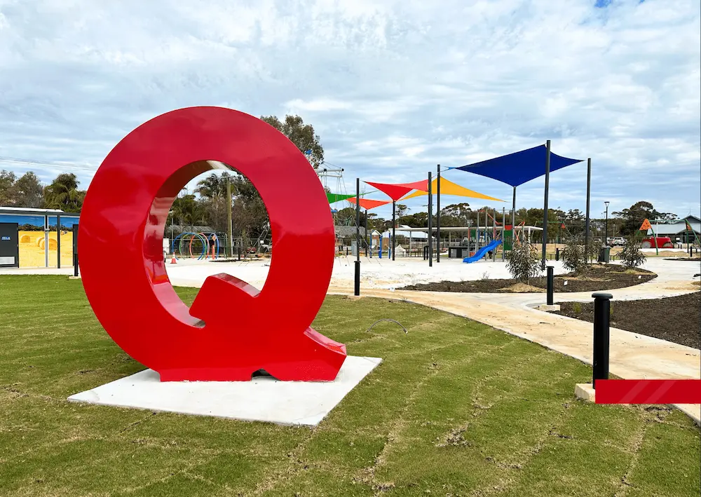
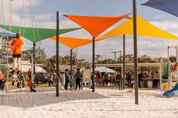
Officially opening in 2024, Kwirrading Koort is a welcoming place to play, relax and spend time together. The adventure playground offers plenty of opportunities for kids to climb, explore and let their imaginations run wild, while the surrounding park provides a peaceful spot for families and visitors to unwind. Keep an eye out for Quairading’s famous Big Everlasting Wind Wheels, adding a touch of colour, movement and local character to this much-loved town space.
With BBQ facilities available, Kwirrading Koort is an ideal place to stop for a picnic or enjoy a relaxed outdoor meal while the kids make the most of the playground. Whether you’re travelling through town, meeting up with friends or simply looking for somewhere to stretch your legs and enjoy the outdoors, Kwirrading Koort is a great place to pause, play and soak up the welcoming spirit of Quairading.
Address: Corner of McLennan St and Parker St, Quairading.
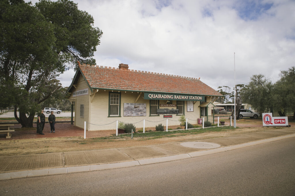
Quairading Railway Museum
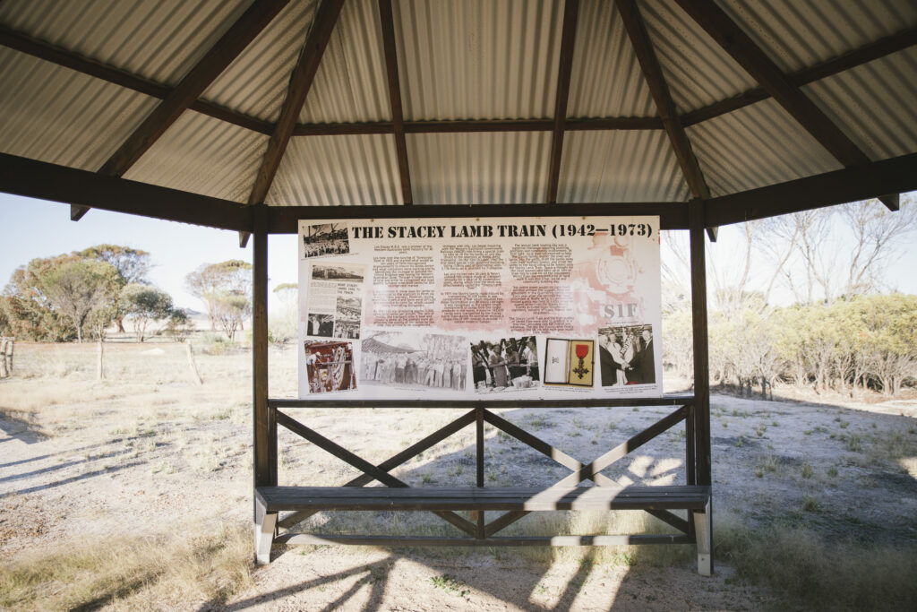
Step back in time at the Quairading Railway Museum and discover the important role the railway played in the development of our town and surrounding farming communities. Housed in the historic railway precinct, the museum offers a glimpse into Quairading’s past, with displays and memorabilia bringing to life the people, stories and everyday experiences connected to the railway.
Outside the museum, the Stacey Lamb Train Display is a striking tribute to Quairading’s railway heritage and a great spot for a photo. Nearby, the Sikh Memorial recognises the contribution and history of the Sikh community in the Quairading district, adding another important chapter to the story of our town. Together, these features make the railway precinct a place to explore Quairading’s heritage, celebrate its people and reflect on the diverse stories that have helped shape our community.
Address: Located on the main Quairading-York Road between the War Memorial precinct and the Quairading Vintage Club sheds and yard
For more information about what there is to see and do, and where to stay in the Shire of Quairading visit:
Connect with the Shire of Quairading
Address:
Phone:
Email:
Website:
Facebook Link:
10 Jennaberring Road, Quairading WA 6383
(08) 9645 2400
[email protected]
https://www.quairading.wa.gov.au/
https://www.facebook.com/ShireofQuairading/
